|
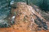
IDENTIFYING THE PROBLEM: What causes drainage of polluted mine water into Chartiers Creek and its tributaries? Chartiers Creek dissects the Pittsburgh Coal seam. Discharges on the east side of the creek are hydrologically separated from ones on the west. The Pittsburgh Coal outcrop crosses Chartiers Creek just south of Bridgeville and Millers Run, southwest of Gladden. The primary mining method to extract coal in the watershed was to deep mine. Where the coal outcrops at the surface, a tunnel (drift entry) is started at the outcrop and follows the coal into the ground. Typically these “drift mines” begin at the lowest coal outcrop elevation and the mine is extended up the dip slope. Any ground water will flow down slope on the floor of the mine and out the entry. The mine would then not flood and no pumping would be required. Where the coal is below the ground and does not outcrop, a shaft or slope is dug either vertically or on an inclined slope to get to it. Then lateral tunnels are dug to remove, or mine, the coal. These form a network of tunnels, whose ceilings are supported by pillars. This is called “room and pillar mining”. Sometimes the pillars are removed as the mining retracts from a fully developed zone. As these mines are often below the ground water table, seepage must be pumped out to maintain a workable mine. When the mine is abandoned, the pumps are removed and the mine floods, pooling the seepage. The mine slope will direct infiltrating water to a discharge point at the surface outcrop or water will collect in a low point and form a mine pool, which will fill until it reaches the elevation of an outlet, or surface discharge. The outlet could be a shaft to the surface, a drift entry, a man-made cut, such as a strip mine, or a natural fracture in the rock substrata. Nine major discharges from these underground mines have been identified in the Chartiers watershed within Allegheny County.
|
|
UNDERSTANDING THE PROBLEM: How can we clean up this mine drainage? The key lies in investigating the scope of the problem. An initial two year DEP Growing Greener study of nine major AMD discharges to the main channel of Chartiers Creek between Bridgeville and Carnegie was concluded in July 2003. Aimed at monitoring the flow and chemistry of each surface discharge and gathering and digitizing maps of the deep underlying mines in order to develop a GIS map-based hydrologic model, the study served to update our understanding of this leading threat to water quality in the lower Chartiers watershed, since it was last studied by the 1970 Operation Scarlift survey. In that thirty-year span much had changed. New discharges appeared, others disappeared, discharges changed in chemistry and flow, and information about the mines grew. With the completion of the Lower Chartiers Creek Rivers Conservation Plan in March 2001, this study was considered the first implementation of any of its recommendations. It serves as the first step, an understanding of the discharges and their causes, which now advantages us toward remediating AMD impact.
A two-year DEP Growing Greener restoration project took the next logical step toward remediation by using this characterization data to develop and prioritize engineering design options. After reviewing hydro-geological setting with historical mine drainage studies, the most recent discharge data was summarized and loading for the discharges calculated, to assess their impact on water quality on the main channel. Key property owners of potential remediation sites, biological condition of the main channel, public opinion of the project and the potential for industrial and commercial use of treated mine water were also identified. A prioritization matrix was created to evaluate cost-effectiveness of remediation projects. Remediation options for each discharge were developed, along with a detailed conceptual design for the preferred alternative.
As a direct result of this study, more than one million dollars in growing greener grants have been awarded to local watershed groups to design treatment systems for three of the most egregious discharges. South Fayette Conservation Group is managing the Fishing Run project, which will remediate the Gladden discharge. Allegheny Land Trust is constructing a passive treatment system at Wingfield Pines and Stream Restoration, Inc. is remediating another AMD discharge. These projects are in the permitting and early construction phases. In addition, Wanashee Conservancy has been awarded a growing greener grant to characterize the Robinson Run watershed, a large sub-watershed of Chartiers Creek. Along with other conservation activities in the watershed, these projects will draw more attention to building new respect and value for restoring Chartiers Creek. The creek provides aquatic habitat, recreational opportunities such as canoeing, fishing, and wading, and is the source of water and sink for discharges for industries. It is the central component of trails and parks in the riparian corridor.
|